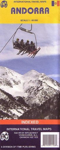
Andorra 1:40,000 Travel Map (International Travel Maps) (French Edition)
R 1,288
or 4 x payments of R322.00 with
Availability: Currently in Stock
Delivery: 10-20 working days
Condition: USED (All books are in used condition)
Condition - Very Good The item shows wear from consistent use, but it remains in good condition and functions properly. Item may arrive with damaged packaging or be repackaged. It may be marked, have identifying markings on it, or have minor cosmetic damage. It may also be missing some parts/accessories or bundled items.
Andorra 1:40,000 Travel Map (International Travel Maps) (French Edition)
Detailed travel map of Andorra shows roads from national highways to unpaved tracks; pedestrian paths and trails; railways; attractions; summits with altitude in meters; settlements; isolated buildings; sports fields; swimming pools; parking; hospitals; scenic vistas; Alpine huts; refuges; mountaineering, climbing, and absailing (cliff descent); Grand Randonee hiking trail; skiing; mountain biking; kayaking; camping; hotels; museums; interesting buildings; tourist information; more. Color changes show elevations. Index of places. Printed on one side. With city map of Andorra la Vella. Main map scale 1:40,000.